The impact and danger of wildfires
This article explains what a wildfire is, the status of wildfires globally, their impact, how Trackplot’s Fire Weather Index and Active Fires data can inform work plans and rescue missions.

What is a wildfire?
Wildfires are large, uncontrolled outdoor fires exceeding 1,000 square metres of burned area on appropriate land types. These fires are unplanned, uncontrolled and unpredictable, and occur in areas with combustible vegetation that can fuel rapid spread.
The status of wildfires globally
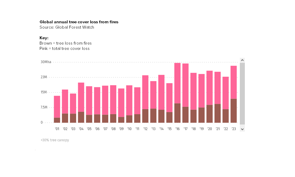
The latest data on forest fires confirms that forest fires are becoming more widespread burning nearly twice as much tree cover today as they did 20 years ago.
Fires were responsible for 28% of tree cover loss globally between 2001 and 2023. There was a total of 138 Mha tree cover lost from fires and 350 Mha from all other drivers of loss. The year with the most tree cover loss due to fires during this period was 2023 with 11.9 Mha lost to fires — 42% of all tree cover loss for that year.
Climate change is one of the major drivers of increasing fire activity. Extreme heat waves are already 5 times more likely today than they were 150 years ago and are expected to increase in frequency as the planet continues to warm. The “fire-climate feedback loop” explains how this cycle is fuelling itself and, combined with the expansion of human activities into forested areas, is driving much of the increase in fire activity we see today:
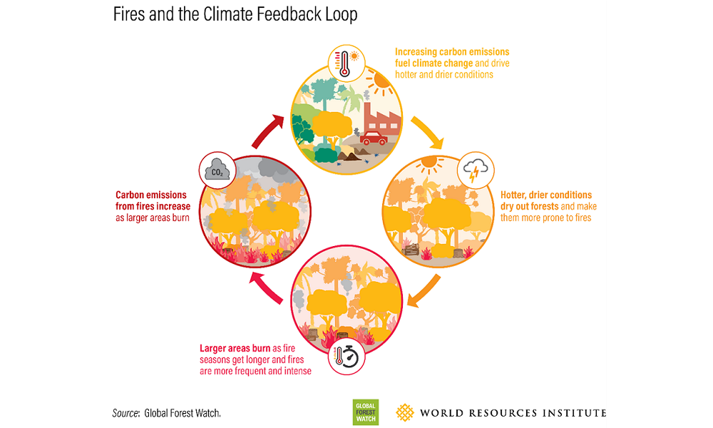
Hotter temperatures dry out the landscape and help create the perfect environment for larger, more frequent forest fires. This in turn leads to higher emissions from forest fires, further exacerbating climate change and contributing to more fires as part of a “fire-climate feedback loop.”
Satellite data suggests the tropics contain around 80% of the approximately 3.5 million km2 of land burned annually worldwide. Tropical wildfires range from vast savanna burning to deforestation and peatland fires. Climate change is occurring most rapidly in northern latitudes, helping to increase the frequency, size, and severity of wildfires in the vast circumpolar boreal forests, which comprise 29% of global forest cover. From 2001 to 2023, Russia was the country with the highest rate of tree cover loss due to fires with an average of 2.53 Mha lost per year.
Predictions for future global wildfire activity
Wildfires influence the carbon cycle, atmospheric chemistry and air quality, climate, ecosystems, and economies. There is projected to be a global increase of extreme fires of up to 14 per cent by 2030, 30 per cent by 2050 and 50 per cent by 2100.
Human settlements at the Wildland-Urban Interface (WUI) are expanding worldwide exposing more people and property to wildfire risks that are complex to assess and difficult to manage. In places such as USA, Australia, Greece, Spain and Portugal most of the direct economic losses from the recent wildfires (and all of the fatalities) occurred at the WUI.
The status of wildfires in the UK
Compared to warmer and drier parts of Europe such as Mediterranean countries the UK suffers relatively little damage from forest fires however they are a growing problem. They mainly happen in areas where grassland or heathland are close to woodlands or where rides (woodland access space) and other open areas provide inflammable vegetation at certain times of the year.
There has been considerable year-to-year variation with high wildfire damage occurring in 1995, 2003, 2011 and 2019 which were associated with particularly dry and warm weather. There is a pronounced seasonality to wildfires, with an early spring peak when there is dry, dead ground vegetation from the previous season, and a later summer peak associated with hot and prolonged dry periods.
The changing UK climate with warmer, drier conditions is likely to increase the risk, timing and severity of forest fires.
The impact of wildfires in the UK
Wildfires have a huge impact on property, infrastructure, the environment and the economy. Fire is almost certain to become an increasing factor affecting the condition and longevity of some woods and forests in sensitive areas.
Wildfires place a huge drain on the UK’s Fire and Rescue Services, diverting resources that might be required at another emergency. They pose a significant threat to the safety of firefighters and the communities they protect.
How Trackplot can help
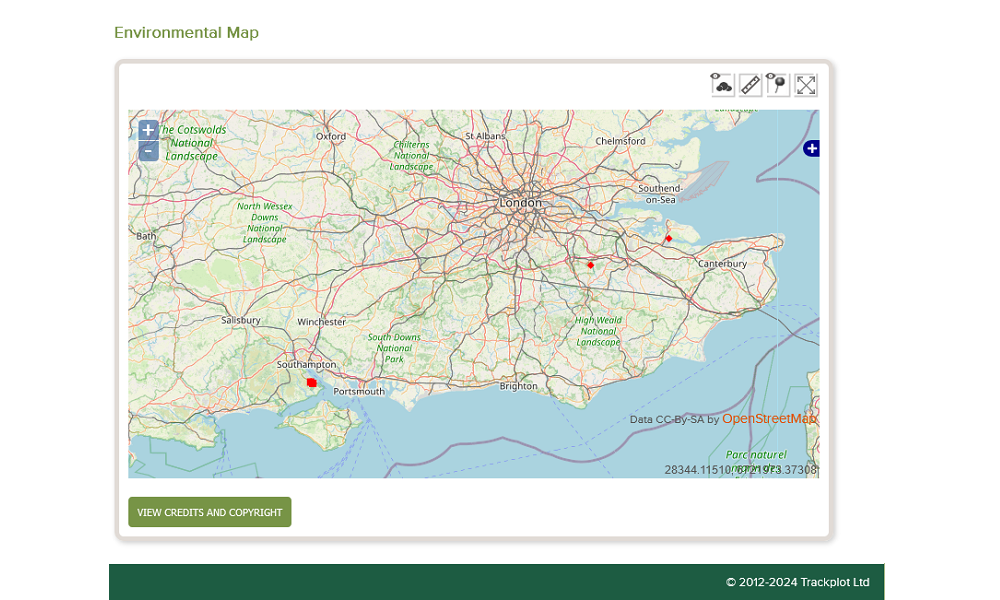
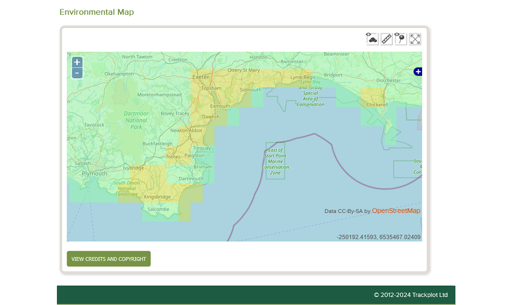
Trackplot provides a real-time Environmental mapping service which is accessible 24/7. This information overlays the Ordnance Survey mapping in the Trackplot Portal so you can determine the risks to lone workers of weather and environmental conditions. Useful to plan and schedule work and assess lone worker vulnerability if there is an Overdue, Assistance Required or SOS incident.
This UK-wide data includes:
-
A Fire Weather Index (FWI)
This meteorologically based index is used worldwide to estimate fire danger. It estimates forest fire ignition and spread conditions based on several weather variables (temperature, precipitation, relative humidity and wind speed).
KEY: Green = Low Danger; Yellow = Moderate Danger; Amber = High Danger; Red = Very High Danger; Dark Red = Extreme; Black = Very Extreme Danger.
-
Active fires
Located on the basis of the so-called thermal anomalies produced by them. The temperature of a potential fire is compared with the temperature of the land cover around it; if the difference in temperature is above a given threshold, the potential fire is confirmed as an active fire or “hot spot”.