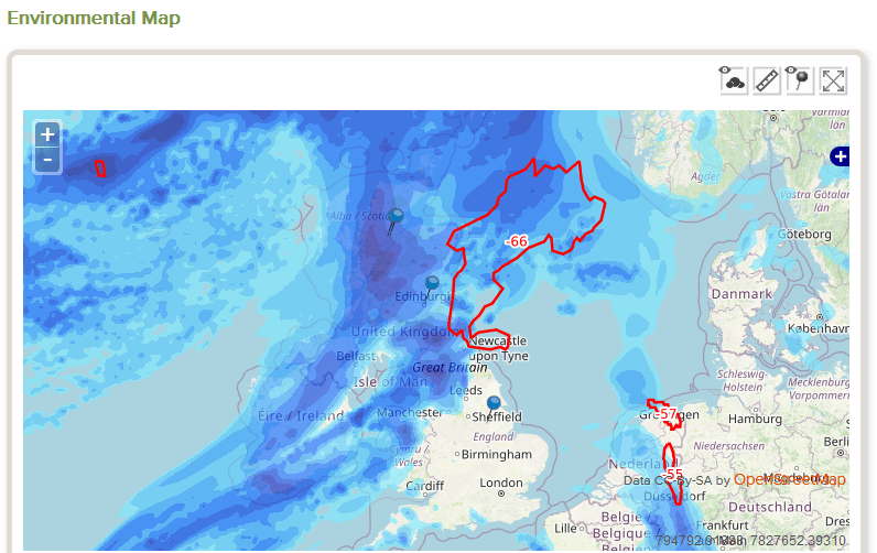
Rapidly Developing Thunder Storms – new Trackplot service
Trackplot is excited to launch new “Nowcasting” functionality to advise where thunder storms may quickly develop. Trackplot customers can use this information to alert their outdoor workers or those travelling to affected locations of the extreme weather conditions and to agree the best course of action.

This new capability quickly follows the launch of Trackplot’s Met Office Weather Warnings Service and it’s existing Environmental Maps Service. Collectively this data enables customers to prevent injury to workers and damage to property and infrastructure.
Climate change predictions for warmer wetter weather mean more frequent and more severe summer storms. Be ready using Trackplot’s Rapidly Developing Thunder Storm service.
This “real-time” dataset, with a latency of approximately 1 hour, uses the identification, monitoring and tracking of intense convective system clouds (cumulonimbus) to notify the potential of rapidly developing thunder storms. Using satellite data the parameters analysed include motion, cooling rate and cloud top height to detect the development of the thunder cell which can happen very quickly.
The Rapidly Developing Thunderstorms data provides information on clouds related to significant convective systems, from mesoscale (200 to 2000 km) down to smaller scales (tenths of km).
Nowcasting is the contraction of two words, “forecasting” and “now”, and means making forecasts about the current conditions.
Published online by Forestry Journal
